

Urban Train Map Puerto Rico | 16 Stations Route

On this page you will have the map of the Puerto Rico Urban Train to use it when you need it or when planning your trip. 

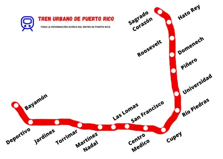
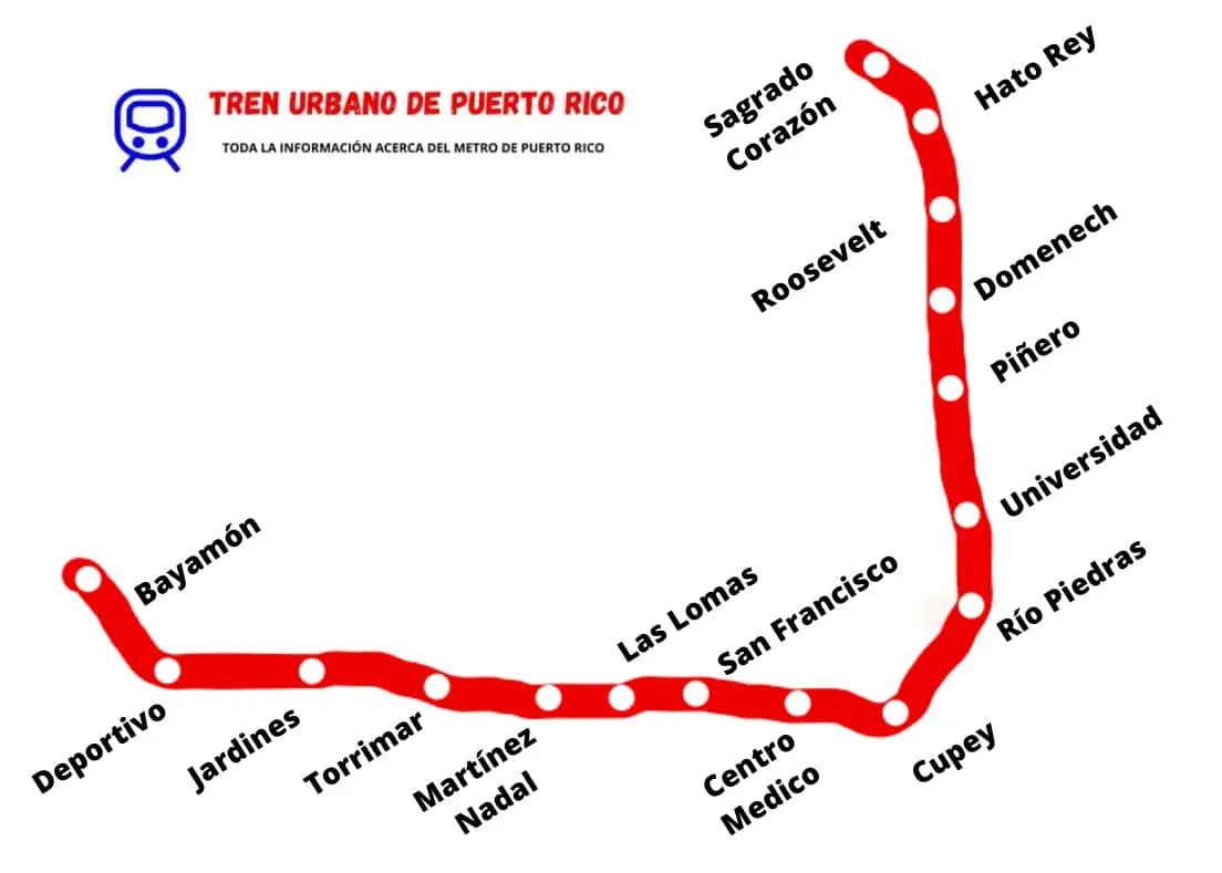
In the following image, you can see the layout of the stations along this means of transport.

Puerto Rico Urban Train map with its 16 stations

Why Use the Puerto Rico Urban Train Map

Having the Puerto Rico Urban Train map makes planning your trips much easier.

If you download it to your phone, you can check it anytime, even offline.

Seeing the full line at a glance helps you plan the trip in advance: identify your origin and destination stations, count how many stops are between them, and combine several errands in a single trip.

Download the Urban Train Map in PDF

If you want or need to download the Puerto Rico Urban Train map, you can do so using the following button:

What to See on the Urban Train PR Map

On the Puerto Rico Urban Train map we can see the entirety of the stations or stops that make it up, as well as the locations of the stations, so we can take into account the time it will take us to make a trip, depending on the origin and destination stations.

In addition, with the map of this means of transport you can see the stations that are before and after each one, which is very useful to know how far we have to travel

For this, we can help ourselves with a schedule, which we will find by clicking the following button:

Stations on the Urban Train Map

If you would like to check any particularity of any station when preparing the trip, you can do so through the following list, simply by clicking on the station to check:

If you would like to check information about the cost of fares to use this means of transport, you can do so through the following button:

View Puerto Rico Urban Train on Google Maps

If you’d rather view the Puerto Rico Urban Train on Google Maps, here’s a link so you can access it: Google listing.

Do you need more details or additional information? You can send us a suggestion through the following form and we’ll answer your question.

For any inquiry, click here to find the passenger service channels.

Frequently Asked Questions Urban Train Map

Here you will find answers to the most common questions about the Urban Train map.

What is the route of the Urban Train?

The Urban Train has a single line in operation, with 16 stations along about 17 kilometers, across the municipalities of San Juan, Guaynabo and Bayamón.

Where does the Urban Train start and end?

The line runs from Bayamón to Sagrado Corazón. The full trip takes about 28 minutes.

What can you see on the Urban Train map?

The map shows all the stations and their locations, which helps you count how many stops are between your origin and destination.

Which stations connect with the buses?

Five stations also work as AMA bus terminals: Sagrado Corazón, Piñero, Cupey, Martínez Nadal and Bayamón. From them you can reach the rest of the metropolitan area.

Table of Contents